
Further to my recent posts about the river flooding in Weybridge and Walton, I have now found my photographs from the last big flood. In December 2002 and January 2003 the Thames began to flood near where we live.
I didn’t have a digital camera then, so my photos are from scans, but they give an idea of the hight of the river in places. The back road from Walton Bridge to Weybridge (Cowie Sale becoming Walton Lane) was completely flooded and closed by the police, although Peter managed to drive through in his van.
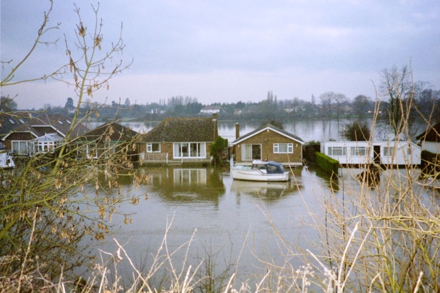
Houses near Walton Bridge. These are built on stilts, but they can’t get there except by boat when the water is this high

Houses near Walton Bridge, cut off by the flood waters
Houses at Walton Bridge

Sunset at Walton Bridge
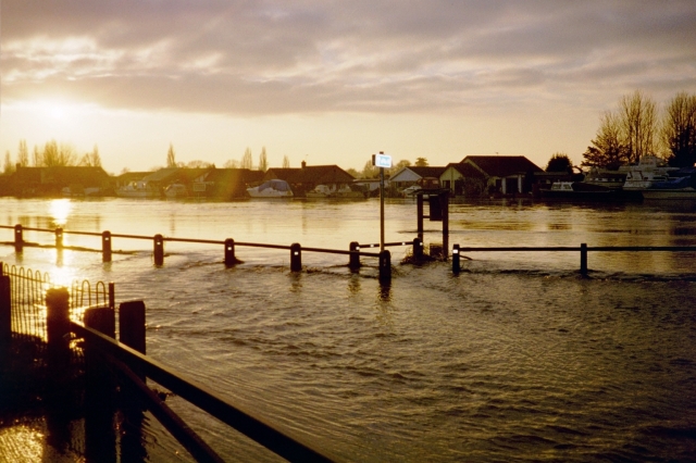
The Road and footpath flooded at Walton, Cowie Sale
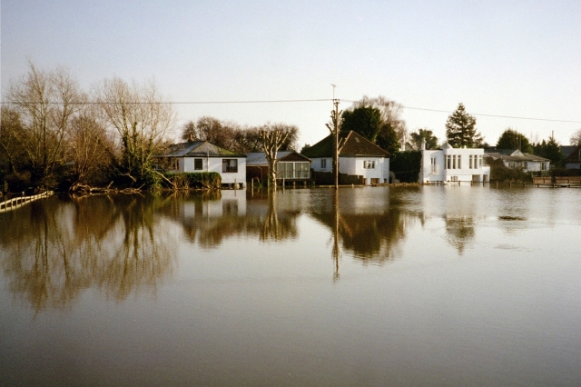
This is how high the water came in Weybridge. The river started to flood the road at the bend just past the Minnow Pub

At the Weir in Weybridge, the river is lapping the road
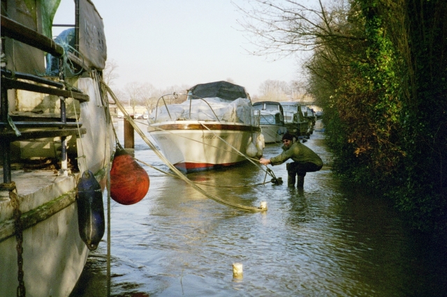
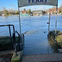
Peter had a boat at Port Hampton (opposite Molesey) The towpath was completely flooded and we had to visit every day to check that the boat was not going onto the path & getting damaged

The car park at Port Hampton is half its normal size
Where is the edge of the path?

Trying to keep the boat from floating up onto the bank, Port Hampton

Water flowing over the head of the Island, Port Hampton
The river Mole regularly overflows at Cobham. In 2003 it was very high
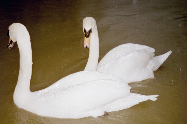
Swans on the flooded Mole at Cobham

Soon after the floods it started to snow, and the flood water froze causing havoc!

The River Mole at Cobham
I must take these photos with me, and then try and recreate the same images today so a true comparison can be made. Normally seats and bins are not placed underwater 🙂


Gorgeous pics – they brought the country side alive for me.
LikeLike
Thank you 🙂
They’re not great quality, having been taken before I had a digital camera, But they capture the water levels well
LikeLike
I hope you wear waders!
LikeLike
We did have to, but it’s a long time ago, these photos were from 2003. I just put them up to show a comparison between the current floods and the ones then which were really bad!
LikeLike
Pingback: Welcome to Visitors from 100 different Countries! | Day One
Pingback: River Levels Rising! | Day One
Wtf is “Port” Hampton.
Pretentious, tu?
LikeLike
That’s what it’s called! Have a look on a map! The Island is called Platts Eyot. I didn’t name the place
LikeLike